Introduction
Photogrammetry and remote sensing are two important techniques that are widely used in various fields such as geography, environmental science, urban planning, and natural resource management. While both techniques involve the collection of data from a distance, there are significant differences between them in terms of their methods, applications, and underlying technologies. This article aims to provide a comparative analysis of photogrammetry and remote sensing, highlighting their similarities and differences.
Photogrammetry
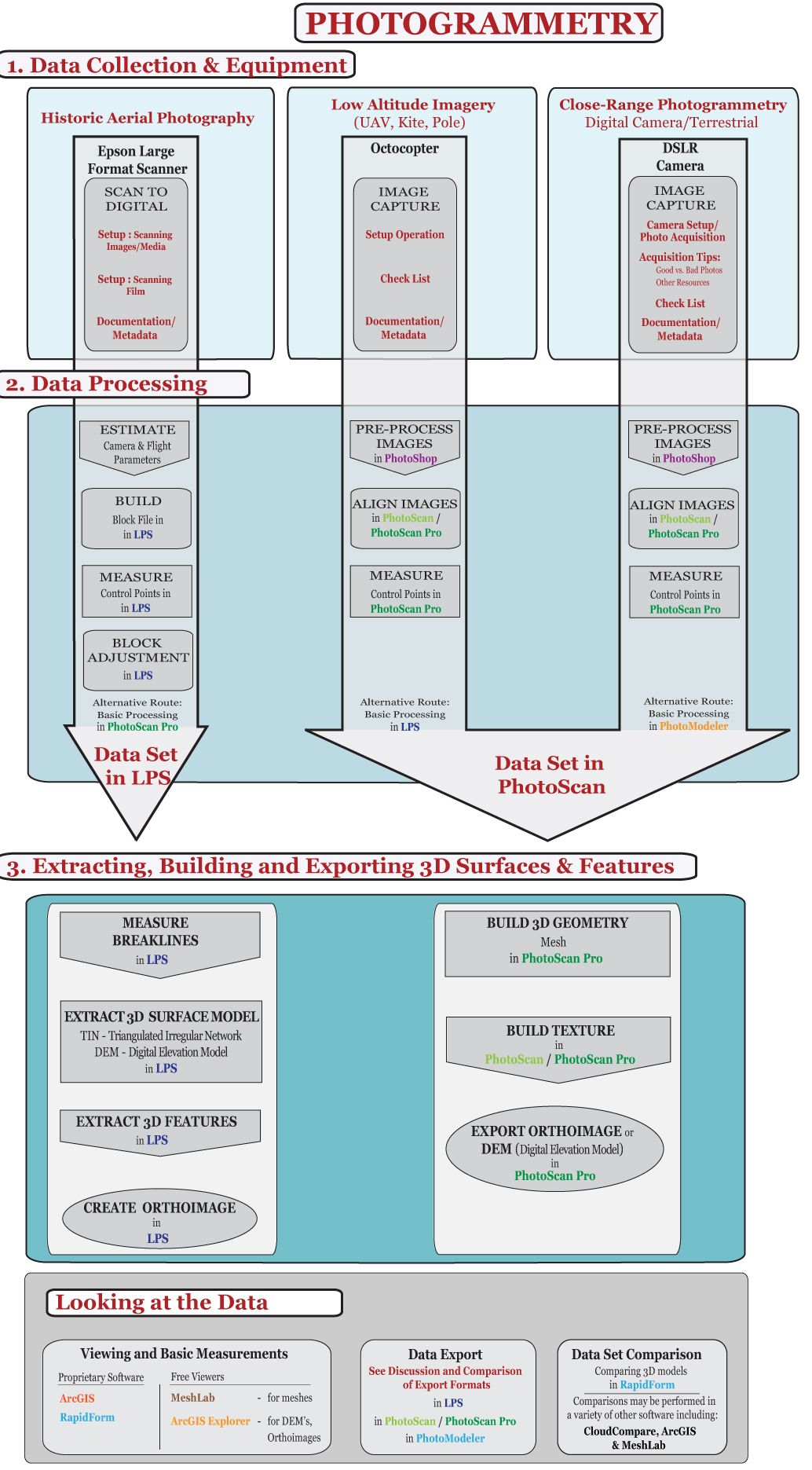
Photogrammetry is a technique that involves the measurement of distances and heights using photographs. It is a branch of surveying that uses overlapping images to create three-dimensional models of objects or areas. Photogrammetry has evolved significantly in recent years, with the advent of digital photography and remote sensing technologies.
Digital photogrammetry involves the use of digital cameras to capture images, which can then be processed using computers and specialized software. This technique allows for the generation of highly accurate three-dimensional models, which can be used for various applications such as mapping, terrain modeling, and even cultural heritage preservation.
Remote Sensing
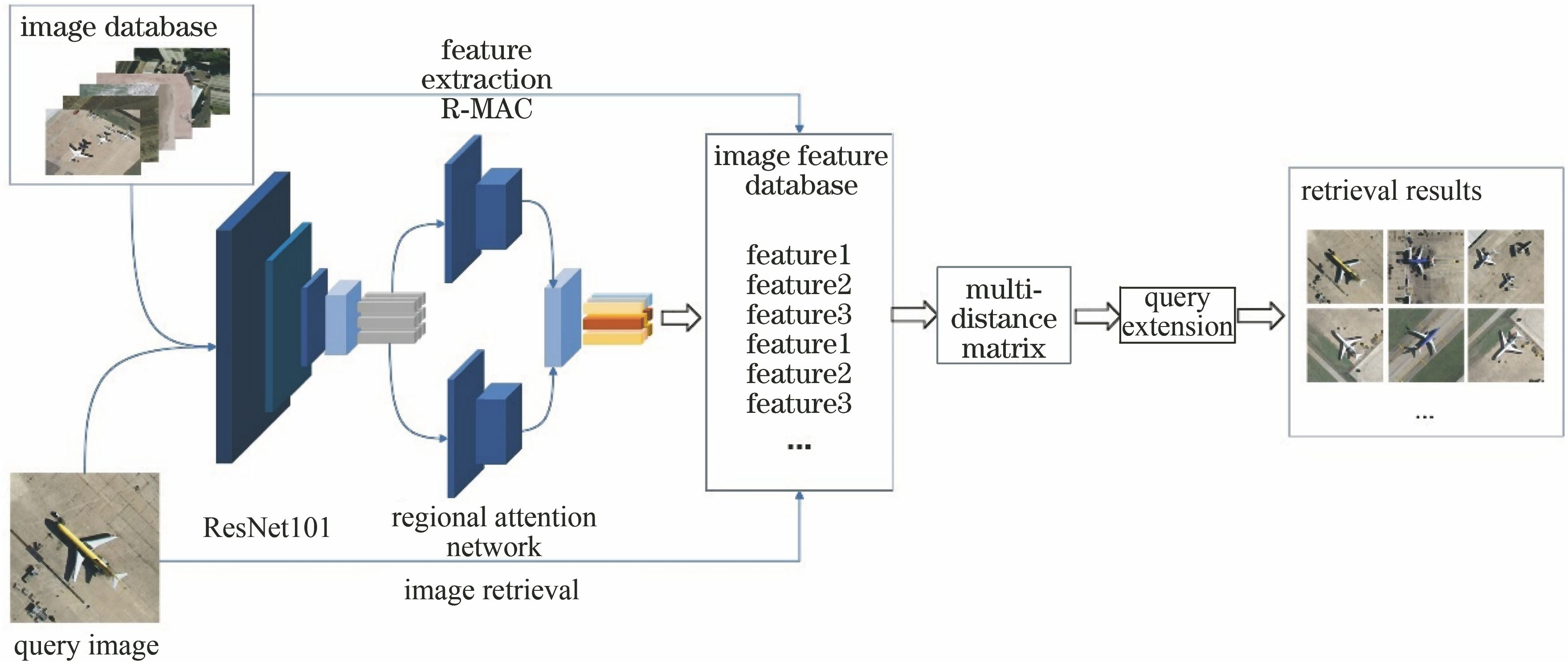
Remote sensing, on the other hand, involves the collection of data about an object or area without being in direct contact with it. It involves the use of sensors, such as those on satellites or aircraft, to collect information about the Earth's surface. Remote sensing data can include images, as well as other types of information such as temperature, humidity, and even chemical composition.
Remote sensing has numerous applications. It is widely used in agriculture, environmental monitoring, urban planning, and natural resource management. For example, satellites equipped with remote sensing sensors can monitor changes in land use, detect forest fires, or even map out water resources.
Comparative Analysis
1、Methods: While both photogrammetry and remote sensing involve the collection of data from a distance, their methods differ significantly. Photogrammetry relies on the analysis of overlapping images to create three-dimensional models. Remote sensing, on the other hand, involves the use of sensors to collect various types of data about an object or area.
2、Data Collection: In photogrammetry, data is collected using digital cameras and processed using computers and software. Remote sensing involves the use of sensors that can be mounted on satellites or aircraft to collect data over large areas. This allows for the collection of data over vast areas in a relatively short period of time.
3、Applications: Both techniques have numerous applications. Photogrammetry is widely used in mapping, terrain modeling, and cultural heritage preservation. Remote sensing, on the other hand, is used in agriculture, environmental monitoring, urban planning, and natural resource management.
4、Accuracy: The accuracy of both techniques depends on several factors such as the quality of the data collected, the methods used for processing the data, and the expertise of the operator. However, with the advent of new technologies and improved methods, both photogrammetry and remote sensing are becoming increasingly accurate.
5、Integration: In recent years, there has been a trend towards integrating photogrammetry and remote sensing techniques. By combining the two techniques, it is possible to create more comprehensive and accurate maps and models. This integration allows for the collection of data from different sources and the use of complementary techniques to enhance the quality of the final product.
Conclusion
Photogrammetry and remote sensing are two important techniques that have numerous applications in various fields. While there are significant differences between them in terms of their methods, applications, and underlying technologies, there is also a growing trend towards integrating these two techniques to create more comprehensive and accurate maps and models. With the continued development of new technologies and improved methods, both photogrammetry and remote sensing are becoming increasingly accurate and will continue to play a vital role in various fields for years to come.







 京公网安备11000000000001号
 京ICP备11000001号
还没有评论,来说两句吧...